Sonar mapping inside Antarctic glaciers

For the first time, a team of Australian researchers has taken the technology used to look into lake and ocean floor sediments and repurposed it to map the internal structure of an Antarctic glacier. The team from Tasmania’s Australian Maritime College are using multibeam sonar technology to try and understand the dynamics of Antarctic ice shelves and the ways they are melting and refreezing.
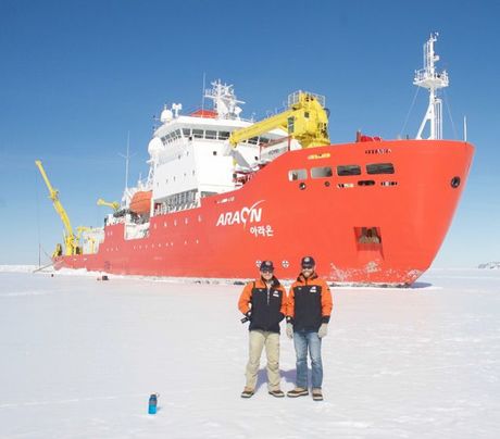
The AMC’s Dr Alex Forrest, postgraduate research student Karl Manzer and AUV Junior Engineer Isak Bowden-Floyd joined a month-long expedition to the Drygalski Ice Tongue in McMurdo Sound aboard the icebreaker RV Araon, belonging to the Korea Polar Research Institute.
Mapping the internal fractures and determining the distribution of glacial ice and frazil or marine ice is aimed at improving understanding of the processes involved in the melting of Antarctic ice shelves and aid in the development of the Antarctic Gateway Partnership’s new autonomous underwater vehicle (AUV).
The Antarctic Gateway Partnership is a Special Research Initiative of the Australian Research Council involving the Australian Antarctic Division, CSIRO and the University of Tasmania.
The AMC team used the multibeam sonar to survey a section of the Drygalski Ice Tongue’s submerged side wall at distances of 100 and 600 metres providing different scales of resolution, as well as a sub-bottom profiler to delve 80 metres into the internal structure of the glacial ice. This is the first time that this technology has been repurposed in this way and the AMC team believe that their research will show that mounting a sub-bottom profiler to the autonomous underwater vehicle under development by the Antarctic Gateway Partnership will help provide new insights into glacial structures.
This expedition also allowed the AMC team to test out the performance of the inertial navigation technology that is a serious engineering challenge in the development of long-range AUV operations. At high latitudes, and especially under ice, the AUV is unable to use GPS to determine its position so it is important to understand the limitations that these conditions place on the inertial navigation system.
This is the second time that Dr Forrest has joined one of the Korea Polar Research Institute’s expeditions and he looks forward to ongoing, long-term collaboration with them. Other contributors to this project include Antarctic New Zealand, IXBlue, EdgeTech and IXsurvey.
Revealed: the complex composition of Sydney's beach blobs
Scientists have made significant progress in understanding the composition of the mysterious...
Sensitive gas measurement with a new spectroscopy technique
'Free-form dual-comb spectroscopy' offers a faster, more flexible and more sensitive way...
The chemistry of Sydney's 'tar balls' explained
The arrival of hundreds of tar balls — dark, spherical, sticky blobs formed from weathered...


